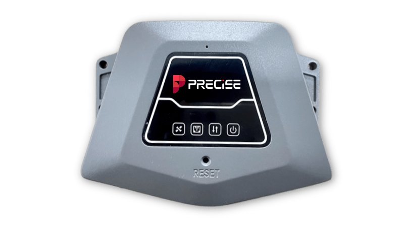
GNSS Reference Receiver
PRECISE C
Redefining CORS with Unmatched Precision and Reliability.
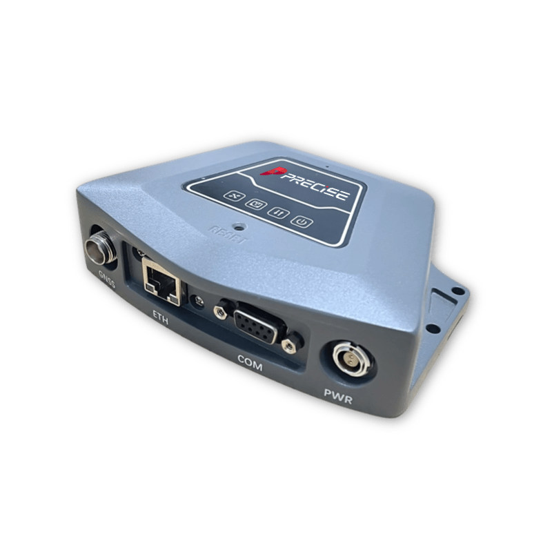
PRECISE C
PRECISE C is a lightweight split GNSS receiver designed for the safety monitoring industry, featuring miniaturization, low power consumption, low cost, high update rate, Gigabit network port, high satellite search quality, etc. Used with a small 3D choke antenna, it can be used as a reference and monitoring station in harsh monitoring scenarios, and is widely used in the fields of bridge monitoring, dams in reservoirs, and other precision structures monitoring.
Full Constellation Tracking
Support main stream GNSS satellite positioning system, support the new frequency of Bei Dou 3, signal stability and reliability.

High Frequency Monitoring
20Hz high frequency monitoring data output as standard, up to 50Hz supported (authorisation required).

Powerful Performance
The mainframe uses a stable Linux operating system and is equipped with a Cortex-A8 processor with strong processing power.

Front-end Resolution
Supports distributed front-end solving to reduce the burden on the server and improve the number of server devices accessed.

Simple Appearance
The whole machine is lightweight and compact, combined with a small 3D choke antenna for use as a lightweight reference station.

Remote Control
Device monitoring, setup and upgrades are achieved through the cloud, reducing the professional requirements of on-site installers.
Detail Specification
SATELLITE PERFORMANCE
| Channels | 800 |
| GPS | L1C/A, L1C, L1P, L2C, L2P, L5 |
| BDS | B1l, B21, B3I, B1C, B2a, B2b, АСЕВОС |
| GLONASS | G1, G2, G3 |
| GALILEO | E1, E5a, E5b, ALTBOC, E6 |
| QZSS | L1C/A, L1C, L2C, L5, LEX |
| SBAS | |
| L-Band | |
| Refresh Rate | 20Hz |
ACCURACY
| Static | H: 2.5mm+0.5ppm V: 5mm+0.5ppm |
| Network PPK | H: 8mm±0.5ppm (RMS) V: 15mm±0.5ppm (RMS) |
Time to First Fix (TTFF)
| Cold Start | 60s |
| Hot Start | 10s |
| Recapture Time | <1s |
Electrical Parameters
| Input Voltage | 8~36V with reverse connection and surge protection |
System Configuration
| Operating System | Linux+A8 |
| Internal Storage | 32G on board, no TF card slot |
| Bluetooth | BT5.0+EDR Backwards Compatible/BLE |
| WIFI | 802.11 b/g/n/ac |
Data Interfaces
| GNSS | 1xTNC female, external GNSS antenna |
| ETH | 1xRJ45, 10/100/1000 Mbps |
| COM | 1xLemo-0 female, 9 pin, DB9 |
| PWR | 1xLemo-0 female, 2 pin, Power Input |
Interaction
| Satellite light | Slow green flash indicates normal operation Fast flashing green indicates no satellite receiving |
| Storage Light | Flashing green indicates storage in progress (synchronised with recording rate) |
| Transmission light | Flashing green indicates transmission in progress (synchronised with the transmitted data rate) |
| Power light | Constant green indicates normal |
Environmental Performance
| Working Temperature | -30°C ~ +65°C |
| Storage Temperature | -40°C ~ +80°C |
| Waterproof and Dustproof | IP67 |
| Drop | Resistant to 2m free fall (concrete hard floor) |
| Humidity | 95 per cent non-condensing |
PHYSICAL
| Dimension | 131mm * 36.5mm * 97mm |
| Weight | 435g |
What our customers are saying about us

Anil Kumar
India
“PRECISE C ensures accuracy and reliability for our agricultural mapping needs.”

Maria González
Spain
“Its consistent precision in harsh environments is unparalleled.”

Alexei Petrov
Brazil
“PRECISE C delivers flawless positioning for our large-scale infrastructure projects.”

John Miller
United States
“PRECISE C has revolutionized our surveying accuracy—reliable, efficient, and easy to deploy.”
Miniaturised Anti-Multipath Antenna
PRECISE AN2
This antenna is a full-band measurement antenna covering GPS L1/L2, GLONASS L1/L2, BDS B1/B2/B3, Galileo E5. It meets the needs of multi-system compatibility of measurement equipment and extremely high precision micro-deformation measurement: it is mainly used in some occasions where there is a very high requirement for measurement accuracy and the surrounding environment has a multipath influence, such as seismic prediction, High-precision differential reference stations and other demanding applications.

Reference Station Antenna
PRECISE AN4
An4 is a 4-system full-band 3D choke antenna covering GPS, GLONASS, BDS, and GALILEO, which meets the current demand for high-precision and multi-system compatibility of measurement equipment. It can be widely used in geodetic mapping, oceanographic surveying, waterway surveying, dredging surveying, seismic monitoring, bridge deformation monitoring, landslide monitoring, terminal container operation and other high-precision occasions.

Take the Leap to Superior Accuracy
Get Your PRECISE Today!
Unlock precision and efficiency with PRECISE. Order now and take your projects to the next level.
Don’t wait—transform your work today!
PRECISE social media:
PRECISE Sales Team: sales@precise-geo.com or clik
PRECISE Tech Team: support@precise-geo.com or clik
PRECISE Marcom Team: marcom@precise-geo.com or clik