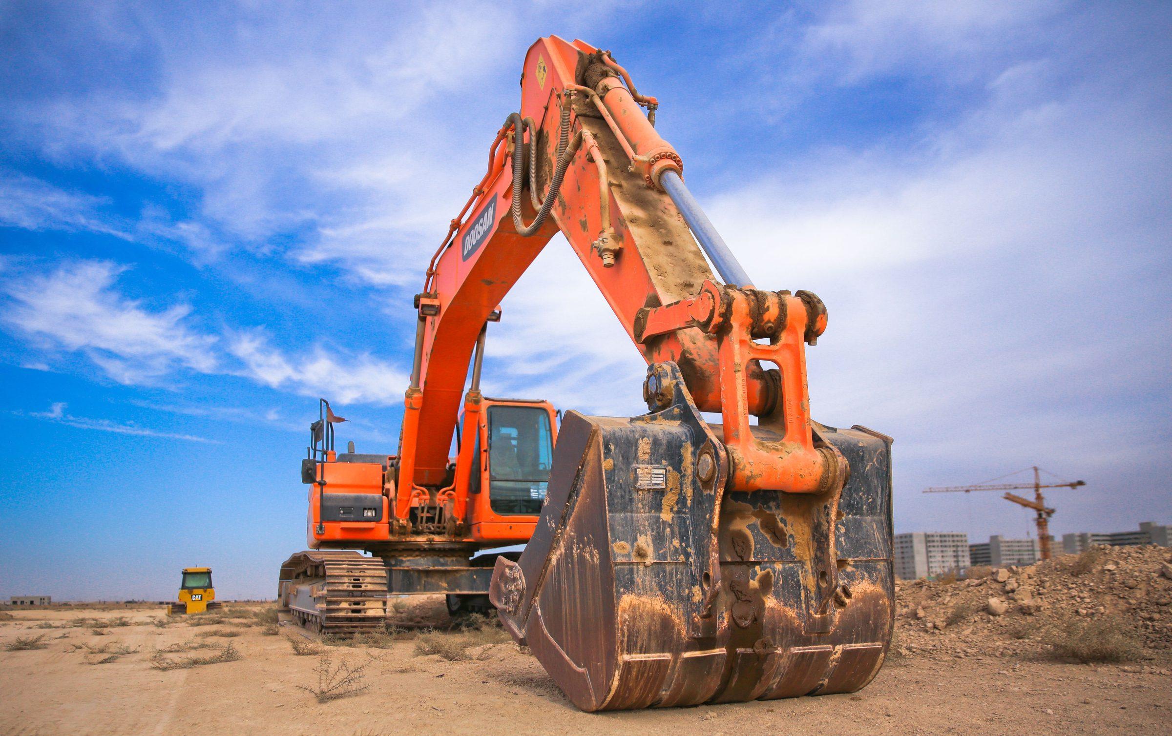
Machine Guidance
One System, Every Attachment, Every Site, All Recorded
3D GNSS guidance that follows the bucket, breaker, or drum cutter you're actually running today, with cloud visibility across every machine and every site.
PRECISE E4D is a 3D GNSS excavator guidance system built for fleets and heavier-duty attachment work, fusing GNSS RTK positioning with tilt sensors to guide fast switching between buckets, breakers, and drum cutters. E4D guides; it never drives the hydraulics or bucket.
Challenge
Fleets running mixed attachments and multiple active sites face a different version of the guidance problem: switching an excavator between a bucket and a hydraulic breaker or drum cutter usually means re-measuring the tool, moving between sites means re-establishing setup, and a site manager off-site has no way to confirm what actually got dug, where, and to what accuracy, until someone drives out to check.
Solution
E4D fuses GNSS RTK positioning with multiple tilt sensors to calculate the bucket's (or attachment's) real-time 3D position, supports fast attachment switching with tooth-tip wear compensation so tools don't need re-measuring, and pushes construction data to a cloud platform for storage, playback, and real-time supervision across multiple sites and projects.
Value
Operators get guidance regardless of which attachment is mounted that day, crews can move between multiple active sites without rebuilding setup each time, and a manager off-site can review real, automatically archived progress data instead of waiting for a site visit.
Key Benefits
Why E4D
Tilt Buckets, Twisting Buckets, Breakers, Drum Cutters
Multi-Attachment Support, No Re-Measuring
A machine running mixed work, digging one day, breaking rock the next, keeps guided accuracy across every attachment change, without downtime for recalibration.
The system stores each attachment's geometry as a profile; selecting the mounted tool loads its profile so the attachment's position is recalculated without a full physical re-measurement, and tooth-tip wear compensation adjusts for gradual wear between full recalibrations.
Automatic Cloud Archiving and Real-Time Supervision
Cloud Data: Storage, Playback, and Remote Supervision
A manager can review real progress and quality data remotely instead of relying on a site visit, and the automatically archived records support quality checks and reporting without separate manual logging.
Construction process data is automatically collected, distributed, and archived to a cloud platform, with real-time supervision and visualized playback of the construction process; outcome reports double as inspection records.
Quick Switching Across Projects, Global Coordinate Library
Multi-Project, Multi-Site Management
Fleets and contractors running several active sites can move machines and operators between projects without a separate setup process for each one.
E4D supports managing multiple projects and sites, with quick switching between them, plus a global coordinate library and multilingual interface for international crews.
15-Minute Calibration, E-Fence and Status Alerts
Fast Calibration, Built-In Safety Guardrails
Machines get back to work quickly after setup, and the e-fence/status-alert features reduce the risk of accidents or damage from operating outside a defined safe zone or from an unnoticed sensor fault.
A calibration procedure that takes about 15 minutes and can be completed by a single operator, plus e-fence avoidance zones and system-abnormality status alerts.
Applications
Where It's Used
Technical Highlights
Engineered Detail
GNSS RTK fused with tilt sensors real-time 3D bucket/attachment position tracking.
Approximately 3cm RMS system accuracy underlying RTK positioning rated at H: 8mm+1ppm / V: 15mm+1ppm.
1,408-channel multi-GNSS chipset BDS, GPS, GLONASS, Galileo, and QZSS support with sub-5-second typical initialization.
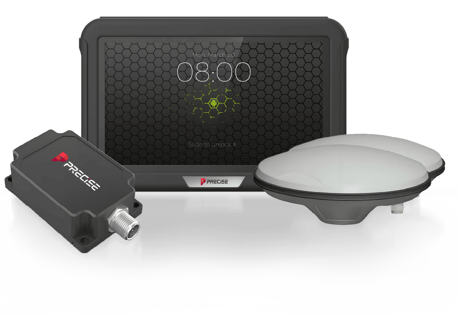
MDP-1 rugged display 10.1" TFT LCD, Android 9.0, IP65, MIL-STD-810 vibration and ISO16750 shock rated, -20°C to +70°C operating.
CAN-bus integration J1939, CANopen, and ISO15765 support, plus RS-232/RS-485/USB/Ethernet and AHD camera inputs for machine-level connectivity.
Cloud platform connectivity data storage, playback, and real-time supervision across sites.
Multi-attachment support tilt buckets, twisting buckets, hydraulic breakers, and drum cutters, with tooth-tip wear compensation.
E-fence and system-status alerts flags unsafe zones or sensor abnormalities.
Technical Specifications
Full Spec Sheet
Display and Control Terminal
System Accuracy
MA Rugged GNSS Antenna
MI-3 Dynamic Inclination Sensor
How It Works
From Setup to Result
Calibrate the Machine
A single operator completes the calibration procedure in about 15 minutes.
Select the Attachment
Choose the mounted tool (tilt bucket, twisting bucket, hydraulic breaker, or drum cutter); tooth-tip wear compensation keeps positioning accurate without re-measuring.
Set the Reference and Guardrails
Establish the project's coordinate system and, if needed, define an e-fence avoidance zone for the site.
Dig with Live Guidance
GNSS RTK positioning fused with the tilt sensors tracks the attachment's real-time 3D position; horizontal guide lines, offset display, and point-mark layout support the operator's guidance view.
Record and Review
Construction process data is automatically collected and sent to the cloud platform, where it can be replayed and reviewed for progress and quality reporting.
FAQ
Common Questions
E4D is a guidance system, not an automatic control system. It fuses GNSS RTK positioning with tilt sensors to track the bucket or attachment's real-time position and displays that against the design target; the operator makes every cut manually.
E4D's overall system accuracy is rated at approximately 3cm RMS, with the underlying RTK positioning rated at H: 8mm+1ppm / V: 15mm+1ppm. Actual results depend on reference setup, satellite visibility, and site conditions.
No. Accuracy is comparable across the PRECISE Machine Guidance lineup. E4D's differentiation is workflow: fast switching between attachments without re-measuring, multi-site fleet management, and cloud-based data recording, not tighter raw positioning accuracy.
Yes. E4D supports tilt buckets, twisting buckets, hydraulic breakers, and drum cutters, with bucket tooth-tip wear compensation, so switching attachments doesn't require a full re-measurement.
Construction process data is automatically collected and archived, with playback and real-time supervision available, and outcome reports that can serve as inspection records. PRECISE has not published the specific data fields, retention period, or access-control details; confirm the data granularity and privacy boundaries with your PRECISE contact before deployment.
Calibration takes about 15 minutes and can be completed by a single operator without specialized equipment. Actual time may vary with machine and site conditions.
E4D supports e-fence avoidance zones to flag restricted areas and reduce accident risk, along with system-abnormality status alerts to catch issues from sensor faults or improper operation before they cause a problem.
Yes. E4D supports multi-project and multi-site management with quick switching between them, along with a global coordinate library and multilingual interface for international crews.
Yes. The MDP-1 display is IP65-rated, MIL-STD-810 vibration and ISO16750 shock tested, and rated for -20°C to +70°C operation; the antenna and inclination sensor components carry their own higher ratings (IP69K and IP68 respectively) suited to continuous field exposure.
Get in Touch
Talk to PRECISE About E4D
Tell us about your project and we'll route it to the right PRECISE team.
- Sales: sales@precise-geo.com
- Support: support@precise-geo.com
Run Every Attachment, See Every Site
Tell us about your fleet's mix of attachments and active sites, and our team will walk through how E4D's guidance and cloud reporting fit your operation.