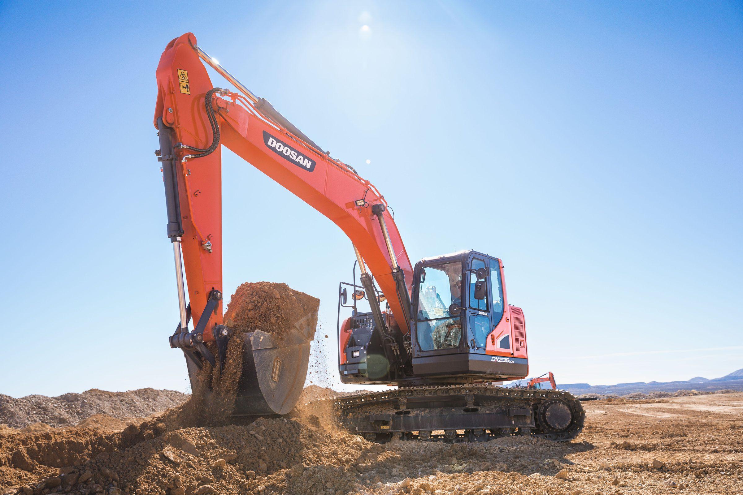
Machine Guidance
From Design File to Finished Grade, See It Before You Dig It
Load the drawing, match the coordinates, and watch the design line appear right on your camera view: leveling, trenching, slope, and AR guidance in one wireless system.
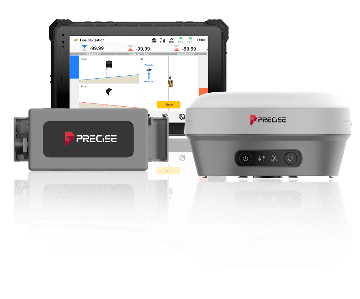
PRECISE E3D is a wireless excavator guidance system built around an AR camera overlay and direct design-file import, matched to a library of 6,000+ predefined coordinate systems. E3D guides; it never drives the hydraulics or bucket.
Challenge
Projects like farmland drainage, road alignment, slope construction, or solar pile layout usually start with a CAD or GIS design file. Getting that design onto the actual job site, in the right coordinate system, translated into something an excavator operator can act on, normally still means a separate survey step: someone walks the site with its own instrument, sets stakes or markers, and relays instructions to the machine. Moving to a new site means re-establishing control and coordinates all over again.
Solution
E3D imports the design file directly (DWG, DXF, SHP, KML, XML) and matches it to the project's coordinate system from a library of 6,000+ predefined systems, with grid and geoid models downloaded online for fast setup in a new area. The operator then works in Leveling, Line Guidance, Slope Construction, or AR Guidance mode, with the AR camera overlaying the design line and bucket path directly onto the live camera view.
Value
The design intent moves from the office straight into the cab, already matched to the site's coordinate system, with visual guidance the operator can act on immediately: no separate stake-out pass, and no manual coordinate setup. The same hardware set doubles as an RTK rover, so a crew that needs a quick site check doesn't need a second instrument.
Key Benefits
Why E3D
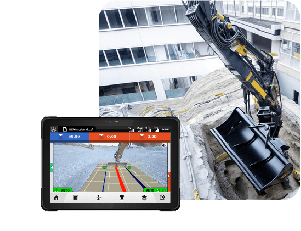
Live AR Overlay on the Camera View
AR Camera Guidance
The operator sees where to dig relative to the design as an image, not a number they have to translate into a direction themselves, cutting the guesswork out of aligning the bucket.
The camera pair captures the live jobsite view while the GNSS/IMU stack tracks bucket position; the system renders the design geometry as an overlay on that camera feed, updated continuously as the machine moves.
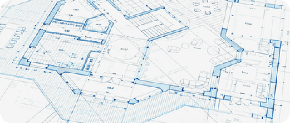
Direct CAD/GIS Import, 6,000+ Coordinate Systems
Design File In, No Manual Coordinate Setup
The engineering design goes straight from file to field without manual re-entry of coordinates or control points, and moving to a new region doesn't require sourcing a local coordinate system separately.
Direct import of DWG, DXF, SHP, KML, and XML design files, matched against a library of 6,000+ predefined global coordinate systems with online grid and geoid downloads.
Dual-Use RTK Rover Mode
Multi-Purpose: One System for Surveying and Construction
A crew doesn't need a separate RTK receiver for site checks or control point work: the same hardware covers both the survey step and the excavation step.
The same GNSS receiver, IMU, and T10 tablet set can run as a standalone RTK rover for point collection and stakeout, or mount on the excavator for guided digging.
10-Minute Install, 25-Minute Calibration
Fast, Wireless Deployment
The system moves between excavators or job sites within the same day, without a lengthy re-setup each time.
Modular wireless components install in about 10 minutes and calibrate in about 25 minutes.
Applications
Where It's Used
Technical Highlights
Engineered Detail
Multi-GNSS receiver 1,408 channels (GPS, GLONASS, BeiDou, Galileo, QZSS, IRNSS, SBAS, HAS-PPP) for stable positioning across regions.
Dual 5MP cameras forward and downward, 83° field of view, driving the real-time AR overlay.
IP68 base unit operating -35°C to +60°C, with a built-in 7.4V/4900mAh battery and 30W PD fast charge.
IP67-rated IMU unit -40°C to +60°C operating, with 84 hours of continuous battery operation.
T10 Android tablet Android 15, 4GB RAM / 64GB flash, under 700g, running the guidance and design-import software.
Integrated connectivity 4G (dual-SIM capable), Wi-Fi, Bluetooth, and built-in UHF radio (410–470MHz / 902–928MHz) for correction data without extra modules.
32GB internal data storage rover mode rated for 15 hours and base mode for 10 hours on internal battery, static over 25 hours.
10-minute install, 25-minute calibration designed for quick redeployment across machines and sites.
Technical Specifications
Full Spec Sheet
Receiver — GNSS
Receiver — Camera
Receiver — Hardware
IMU
T10 Tablet
RTK Magnetic Holder
Communication Configuration
How It Works
From Setup to Result
Import the Design
Load the project's CAD/GIS file (DWG, DXF, SHP, KML, or XML) into the system.
Match the Coordinate System
Select from 6,000+ predefined global coordinate systems, with grid and geoid models downloaded online, so the design lines up correctly with the site.
Choose a Guidance Mode
Set Leveling (unified elevation), Line Guidance (straight-line elevation for trenching/channels), or Slope Construction (longitudinal and cross slope) depending on the task.
Dig with AR Guidance
The camera overlays the design line, bucket path, and target markers on the live view, so the operator can align the bucket by sight.
Adjust and Verify
The operator corrects each pass against the overlay; the same hardware can be detached and used as an RTK rover to spot-check the result.
FAQ
Common Questions
E3D is a guidance system, not an automatic control system. It does not move the bucket or control the hydraulics. It overlays the design line and bucket path on the operator's camera view and shows guidance data, and the operator makes every cut manually based on that information.
E3D delivers approximately 3cm accuracy when the tilt angle is 60° or less from vertical. PRECISE has not published accuracy behavior above that tilt threshold; confirm with your PRECISE contact for applications involving steep bucket angles.
No. Accuracy is comparable across the PRECISE Machine Guidance lineup. E3D's differentiation is workflow: AR-guided visualization directly from a design file, plus dual use as an RTK rover, not tighter raw positioning accuracy than E2.
Yes. The GNSS receiver, IMU, and T10 tablet set that mounts on the excavator can also be used as a standalone RTK rover for point collection, stakeout, or site checks: it's the same hardware in a different physical setup.
E3D imports DWG, DXF, SHP, KML, and XML files directly, and includes over 6,000 predefined coordinate systems with online grid and geoid model downloads for fast setup in a new area.
Typical install takes about 10 minutes and calibration about 25 minutes, and the modular, wireless components are designed to move between excavators or job sites without a lengthy re-setup. Actual time varies with machine and site conditions.
E3D has an integrated 4G modem (dual-SIM capable), Wi-Fi, Bluetooth, and a built-in UHF radio (410–470MHz / 902–928MHz), so it can receive RTK corrections over cellular network or a local base station without extra external modules.
Yes. The base receiver unit is IP68-rated for -35°C to +60°C operation, and the IMU unit is IP67-rated for -40°C to +60°C operation, suitable for wet sites, cold mornings, and hot afternoons.
Get in Touch
Talk to PRECISE About E3D
Tell us about your project and we'll route it to the right PRECISE team.
- Sales: sales@precise-geo.com
- Support: support@precise-geo.com
See Your Design On Site
Bring your project's design file and let our team show you how E3D matches it to your coordinate system and guides the cut.